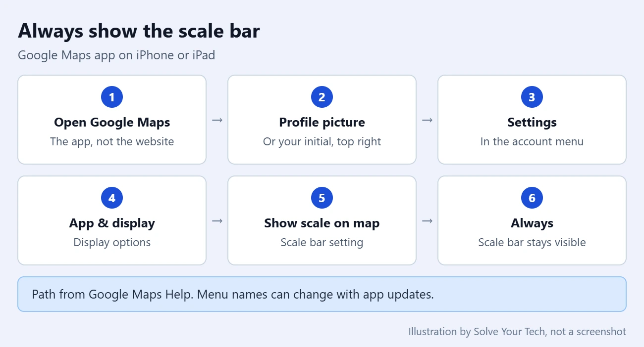
To always show the scale in Google Maps on an iPhone, open the Google Maps app, tap your profile picture or initial, then go to Settings > App & display > Show scale on map and choose Always. The scale bar then stays on the map instead of appearing only while you zoom.
The scale bar is the small ruler on the map that tells you how much real-world distance a short line on the screen represents. Because pinching to zoom changes that distance constantly, keeping the bar visible makes it easier to judge how far apart two places really are.
What You Need
This guide follows the path Google lists in its current Google Maps Help page on the scale bar for iPhone and iPad. It applies to the Google Maps app, not to Apple Maps, which is a separate app with its own settings.
- The Google Maps app. If it is not on your phone yet, see how to get Google Maps on an iPhone.
- A recent version of the app. Google moves settings between menus from time to time. If your menus do not match the steps below, update Google Maps in the App Store first.
- About a minute. The change is a single setting, it costs nothing, and you can switch it back whenever you like.
How to Always Show the Scale Bar in Google Maps on an iPhone
These steps are the same on an iPad.
- Open the Google Maps app.
- Tap your profile picture or initial. It sits beside the search bar at the top of the map. A menu for your account opens.
- Tap Settings.
- Tap App & display.
- Tap Show scale on map. You will see two choices: When zooming in and out and Always.
- Tap Always.
- Go back to the map. The scale bar should now be visible without you touching the screen.
Nothing else in the app changes when you pick this option. Your saved places, routes, and navigation settings are left alone.
What the Two Scale Options Mean
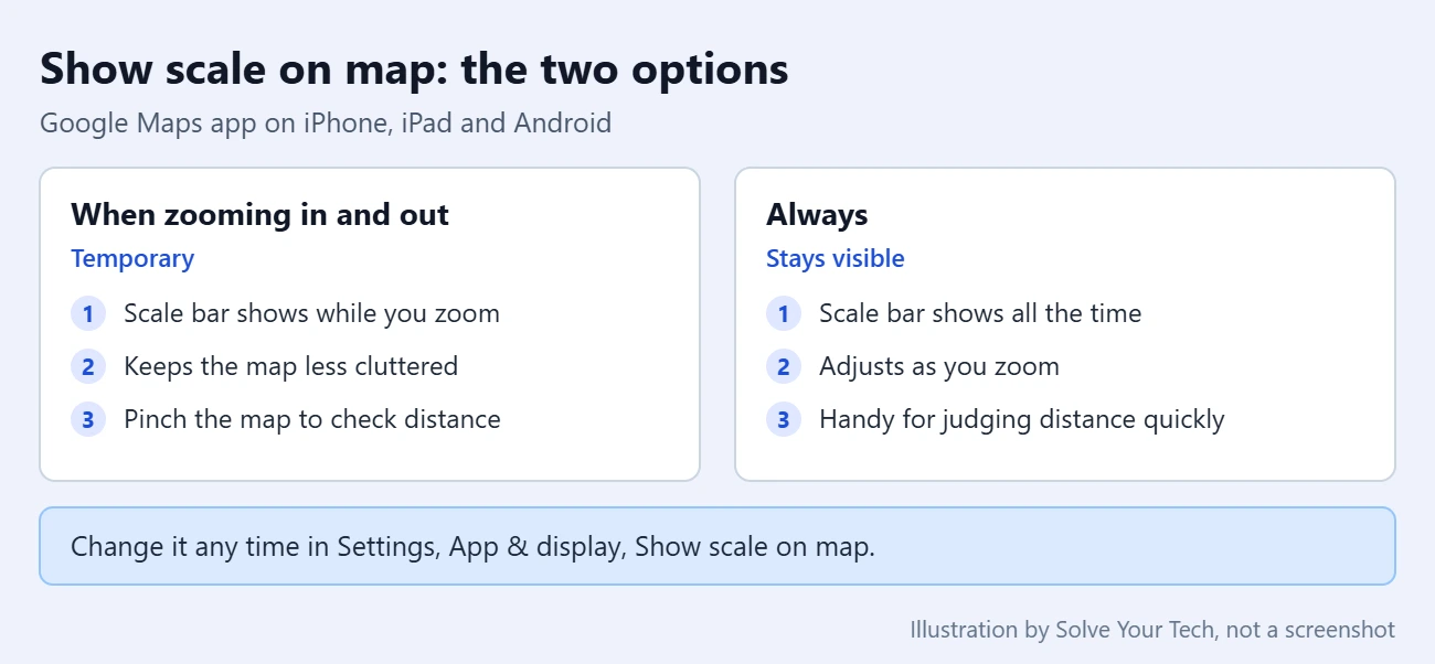
Google gives you only two choices for the scale bar. There is no option to hide it completely.
| Option | What it does | Good for |
|---|---|---|
| When zooming in and out | The scale bar shows while you change the zoom level, then goes away. | A cleaner map with fewer things on the screen. |
| Always | The scale bar stays on the map all the time. | Checking distances at a glance without pinching the map. |
How to Confirm It Worked and How to Undo It
Return to the main map and leave the screen alone for a few seconds. If the scale bar is still showing near the bottom of the map, the setting is on. Pinch to zoom in or out and the numbers on the bar should change to match the new zoom level.
To go back to the original behavior, repeat the steps and choose When zooming in and out instead of Always.
How to Read the Scale Bar
The bar is a short line with a distance printed next to it. That distance is how far the length of the line covers on the ground at the current zoom level. Zoomed out over a whole state, the line might stand for many miles. Zoomed in on a single street, it usually drops to feet or meters.
To estimate a distance, compare the gap between two places with the length of the bar. If the gap is about three bar-lengths, the places are roughly three times the printed distance apart in a straight line. Roads rarely run straight, so driving or walking distance is usually longer.
In the mobile app the bar typically lists both miles and kilometers, so you normally do not have to switch units to read it. Google does not spell this out in its help pages, so what you see may vary with your app version.
Use Measure Distance for an Exact Number
The scale bar is for quick estimates. When you need a real figure, Google Maps has a Measure distance tool that draws a straight line between points and adds up the total. Google’s steps for the iPhone are:
- Open the Google Maps app.
- Touch and hold a spot on the map that is not a place name or icon. A red pin appears.
- Select Measure distance.
- Move the map so the black circle sits on the next point you want to measure to.
- Tap Add point at the bottom right. Add as many points as you need.
- Read the total distance at the bottom of the screen. It is shown in miles and kilometers.
Tap Undo to remove the last point, or tap More and then Clear to remove them all. Tap the back arrow at the top left when you are done. If dropping pins is new to you, our guide on how to add and save pins in Google Maps covers the basics.
How to Switch Between Miles and Kilometers
Google Maps has a separate setting for the units it uses when it measures distance for directions. According to Google’s directions help page, you change it like this:
- Open the Google Maps app and tap your profile picture or initial.
- Tap Settings, then Navigation.
- Under Distance units, select Automatic, Kilometers, or Miles.
Automatic lets the app pick the unit for you. Google documents this setting for directions and navigation. It does not say whether it changes the units printed on the scale bar, so do not count on it for that.
Scale Bar on Android and on a Computer
Android: Google lists the same path for Android phones and tablets. Open Google Maps, tap your profile picture or initial, then go to Settings > App & display > Show scale on map and pick Always.
Computer: Google’s help page does not list a scale setting for the Google Maps website. In a desktop browser the scale bar normally sits in the bottom-right corner of the map all the time, and clicking it usually switches between miles and kilometers. The website also has its own Measure distance option: right-click your starting point, choose Measure distance, then click elsewhere on the map.
Troubleshooting
There is no App & display option in Settings
Your app is probably on a different version from the one Google’s help page describes. In some earlier versions, Show scale on map appeared directly in the main Settings list, so scroll through that list and look for it by name. If you still cannot find it, update Google Maps in the App Store and check again.
You cannot find the profile picture
Make sure you are on the main map screen and not in the middle of turn-by-turn directions or looking at a place page. Close whatever is open until you see the search bar at the top. If you are not signed in to a Google Account, you will not have a photo, so look for a plain account icon in the same spot instead.
The scale bar still disappears
Go back to Show scale on map and check that Always is the selected option. If it is, close Google Maps completely and open it again. Also confirm that you are in Google Maps and not Apple Maps, since this setting only affects Google’s app.
The scale shows the wrong units
Check the Distance units setting under Settings > Navigation. If the bar already lists both miles and kilometers, read whichever line you prefer.
Frequently Asked Questions
Where is the scale bar in Google Maps on an iPhone?
It appears near the bottom of the map as a short line with a distance next to it. By default it only shows while you zoom in or out. To keep it there, set Show scale on map to Always in the app’s App & display settings.
Can I turn the scale bar off completely?
Google only offers two choices: When zooming in and out and Always. There is no documented option that hides the bar entirely. When zooming in and out is the closest you can get, because the bar goes away when you stop zooming.
Does always showing the scale use more battery or data?
Google does not mention any battery or data cost for this setting. It only controls whether a small label stays on the screen.
Will the setting carry over to my other devices?
Google does not say whether this choice follows your Google Account. Plan on checking the setting on each phone or tablet where you use Google Maps.
Is the scale bar accurate enough to measure a route?
It is fine for a rough, straight-line estimate. For anything more exact, use Measure distance, or get directions and read the distance Google Maps gives for the route.
Next Steps
With the scale bar always on, you can judge distances without pinching the map first. If you want to mark the spot you are standing on next, see how to pin your current location in Google Maps.
Related: how to connect Spotify to Google Maps. If map links from a chat app open in a browser instead, see how to open iPhone Discord map links in Google Maps.

Matthew Burleigh is the founder, head writer, and editor of Solve Your Tech, which he launched in 2012. He has written technology tutorials since 2008 and worked in IT since 2003, including small-business support, IT management, and consulting. He holds Bachelor’s and Master’s degrees in Computer Science from Arizona State University.
Matthew writes practical guides for Windows, iPhone and iPad, Microsoft Office, Outlook, Google apps, and Android. Solve Your Tech’s guides are tested on current devices or checked against official product documentation, with clear steps, sources, and update dates.
Read more about Matthew and how Solve Your Tech writes and updates its guides, or report a correction.